Much of the diving around St Helena is along the north-western facing coast from James Bay, which is sheltered from the prevailing Atlantic currents and diving can be conducted on almost every day of the year, subject to weather conditions. Dive sites in this area are along the shore where the currents are mostly slight, although they can pick up when you get a little further offshore at sites such as the wreck of the RFA Darkdale.
Sites further afield such as Speery Island around the south-western tip of St Helena, or Barn Ledge around the northernmost point of the island can be subject to much stronger currents due to their location, but marine life is more plentiful and they are regularly dived when conditions are good. Large swells occasionally roll in from the open ocean (it is the south Atlantic, after all), although the surge is mostly annoying, rather than dangerous.
Water temperature throughout the year varies between 20 – 28ºC and all the diving is conducted from either RIBs or small boats.
OPERATORS

There are two dive operators on St Helena, Sub-Tropic Adventures run by Anthony Thomas, and Into the Blue run by Craig Yon. There is no physical dive centre on the island, however, Anthony or Craig will pick you up from your accommodation if it’s not in Jamestown. Equipment and tanks are transferred to James Bay wharf by truck, where gear is assembled on the jetty steps prior to boarding.
SEA CONDITIONS

Dive conditions are generally calm and the viz is often upwards of 40m. There is very little current close to shore in the lea of the island, where most of the diving takes place, however, it can pick up as you move out to sea, although it is usually very mild. Currents on the south-eastern side of the island can be very powerful, but the locals know when and where to go should this happen. A measure of swell does roll in off the ocean from time to time; more annoying than dangerous, and brings more limited (but still good) visibility.
WATER TEMP
The water temperature is fairly consistent around the year, varying between 20-26ºC dependent on depth and location. A 5mm full suit and hood should be adequate for most divers, 7mm in the cooler months.
ACCESS
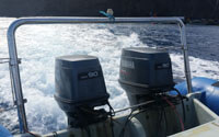
Almost all of the diving is by boat, with the exception of James Bay and the SS Papanui, which is a short swim from the steps. The boats are either hard shell or RIB, with limited or no cover available and little storage. Bring plenty of sun cream and a dry bag to protect personal belongings. Anything not necessary for the dive can be left in the trucks on the jetty.
MARINE PROTECTED AREA RULES
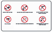
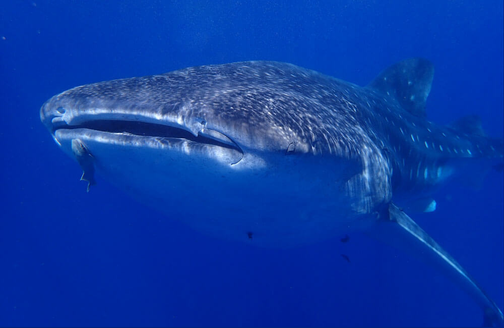
The MPA extends 200 nautical miles from shore and the rules and regulations are fairly standard in terms of the requirements for good buoyancy control, taking only pictures, leaving only bubbles. Divers are not permitted to jump into the water with the whale sharks wearing scuba, but they – and other large pelagics – may pass by for a close inspection while you dive. Divers are required to keep a minimum distance of 3m at all times, however,as with most interactions, it’s not possible to make the whale sharks aware of this rule!
WRECK PENETRATION
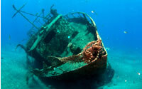
Divers are not permitted, under any circumstances, to penetrate the wrecks. In the case of the RFA Darkdale, this is because the ship is classed as a war grave, although its depth also prevents an extended visit. For the other wrecks it’s simply against the local regulations. Divers should respect these and refrain from swimming inside the wrecks, regardless of how inviting the swim-throughs may look.
NITROX
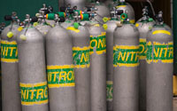
Due to the logistics and expense involved in the manufacture of nitrox in a remote location, non-standard gas mixtures are currently unavailable.
CHAMBER

There is no hyperbaric chamber on the island. However, there is a chamber ready and waiting for shipment from the UK, but as yet there has been no confirmed date for its delivery. Divers should bear this in mind and stick to conservative dive profiles and good dive practice to minimise the risk of DCS. Serious medical emergencies require medevac to Cape Town, and so you may wish to check with your dive insurance company with regards to cover.
LEMON VALLEY POINT

Depth: Average 11m, Max 18m
Description and key features: A great easy dive which starts to the west of Lemon Valley going around the point (deepest part at 18m) and up into the valley where it gradually gets shallower up to 6m. The area has a sandy bottom which makes it a very good site for novice divers.
Diving Ability Level Open Water +
Difficulty Easy
Current Usually slack
Marine Life Possible seasonal devil rays, seasonal ocean triggerfish breeding, you can occasionally hear dolphins
LONG LEDGE

Depth: Average 10-15m, Max 20m
Cave with large entrance and a smaller entrance with skylight. Effectively a wall dive with a sandy bottom. Long Ledge to Billy Mays’ Revenge is identified as an area with the some of the highest biodiversity and abundance of species on the island and is a proposed Marine Biological Reserve.
Diving Ability Level Open Water +
Difficulty Easy
Current: Mild
Marine Life Seasonal nudibranchs, razor fish, devil rays (seasonal), endemic orange cup coral and highly delicate rose lace gorgonian (careful diving required) in caves, long legs crayfish on wreck
Night dives Slipper Lobster, long legs crayfish, octopus, anemones
Additional Features Highly diverse area; cave/swim-though, great night dive
BILLY MAY’S REVENGE
Depth: Average 15m, Max 25m
For more advanced divers a deeper reef (going down from 18m to 25m) can be explored. Lots of large boulders and crevices for smaller things to hide in. Long Ledge to Billy Mays Revenge is identified as an area with the some of the highest biodiversity and abundance of species on the island and is a proposed Marine Biological Reserve.
Diving Ability Level Open Water +
Difficulty Easy
Current Usually slack
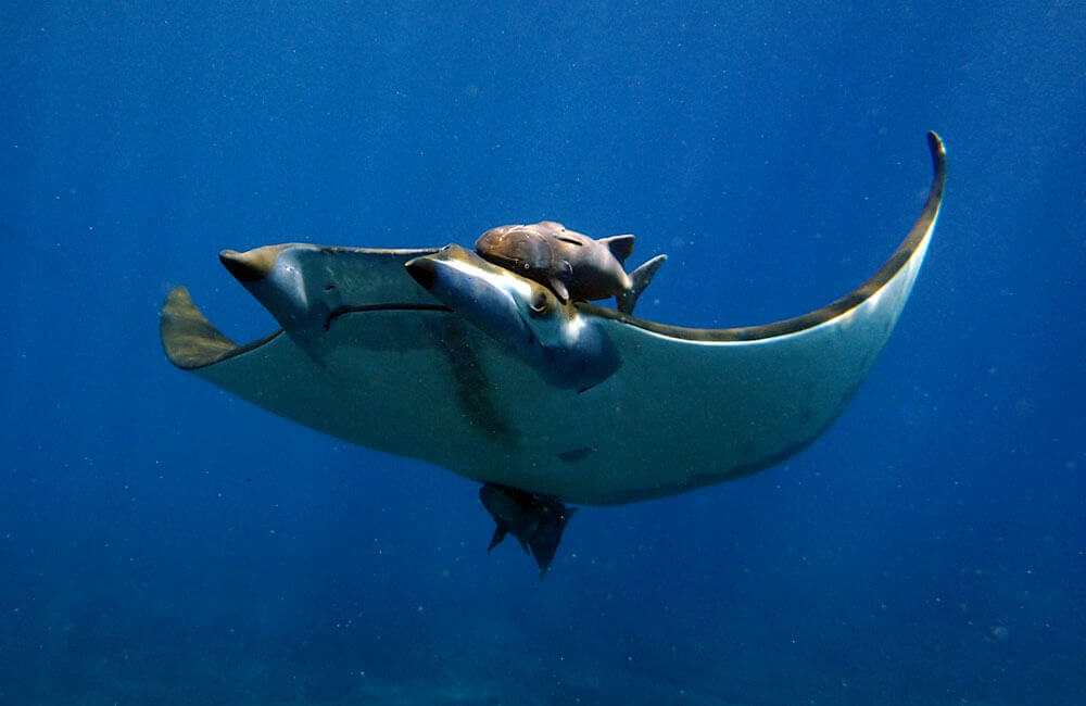
Marine Life Devil rays, cleaner shrimp, highly diverse area
LIGHTER ROCK
Depth: Average 14m, Max 25m
Description and key features: Lighter Rock is an outcrop where just the very tip of the structure sticks out above the water. The outcrop is connected to the main land at Cat Island with a shallow ledge averaging 10m. We generally follow the ledge out on one side go around Lighter Rock itself and back along the opposite side of the ledge. The dive can be made shorter and shallower (18m max) by crossing over the ledge at the base of Lighter Rock. There is a 15m long 2m high swim through close to Cat Island.
Diving Ability Level Open Water +
Difficulty Medium
Current Light, but can be stronger
Marine Life Possible seasonal devil rays, endemic orange cup coral and highly delicate rose lace gorgonian in caves (careful diving required), long legs crayfish
Additional Features Swim-through
BENNETT’S POINT
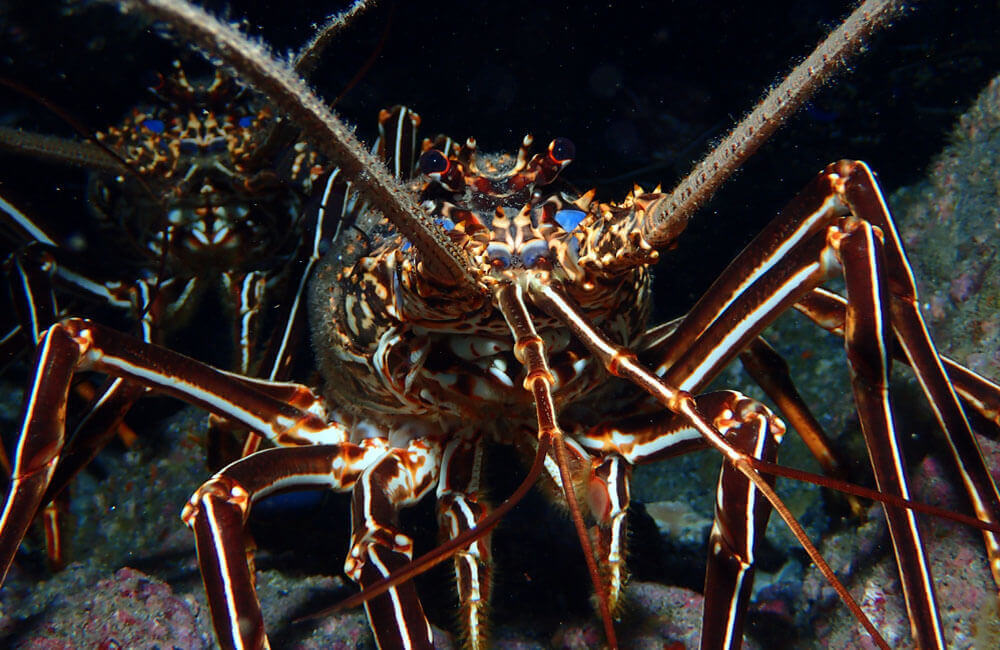
Brown spiny lobsters (Panulis echinatus), known locally as ‘long legs’ frequent the cracks and crevices of Bennett’s Point (Photo: Sub-tropic Adventures)
Depth: Average 12m, Max 24m
Easy dive around the point. A cave near the start and some overhangs, Mixture of terrain, varied habitats. Archway around the point and swim-through at the end in shallow water 6m, good area for safety stop.
Diving Ability Level: Open Water +
Difficulty: Easy
Current: Usually mild
Marine Life: Good place for longlegs (brown spiny lobsters) and seasonal nudibranchs, orange cup coral in the cave and overhangs. Black triggerfish often seen here

EGG ISLAND
Depth: Average 15-20m, Max 30m
Wall of Egg Island. Usually, you dive on the NE side but it is possible for advanced divers to dive on the SW side and around the point, in the right conditions. Dive tends to start deeper and finish in 6-10m; a very healthy dive profile!
Diving Ability Level Open Water +, Advanced Open Water preferable
Difficulty Easy
Current Gentle, but can be significant surge in shallow water depending on sea conditions
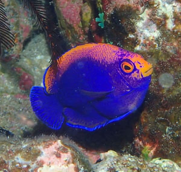
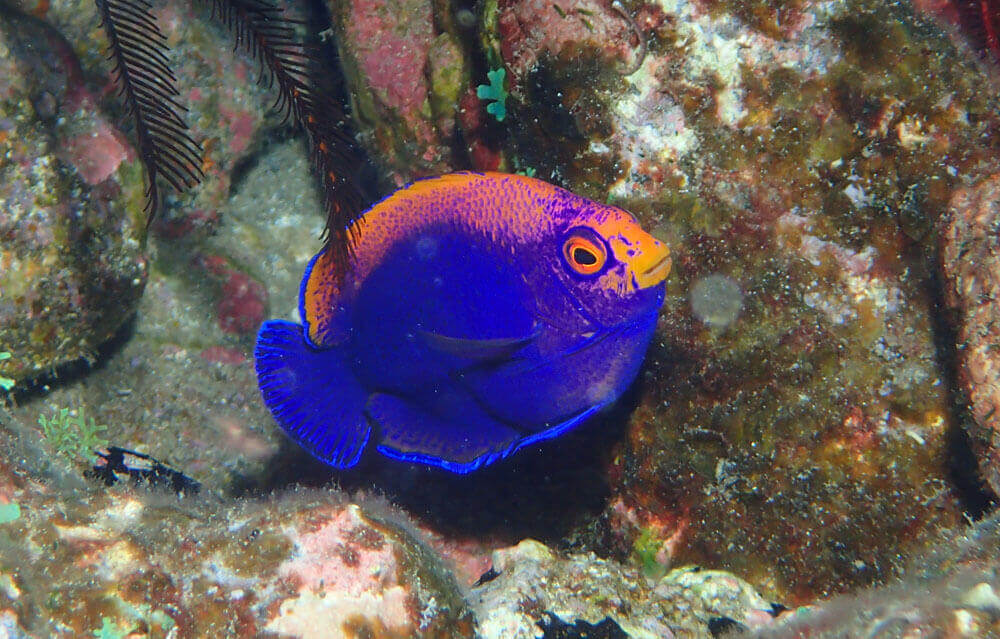
Marine Life Flameback angelfish, nudibranchs (seasonal), devil rays, (seasonal), various jacks and larger fish

THOMPSON’S VALLEY ISLAND
Depth: Average 12m, Max 20m
A small island close to the most south westerly point of the island. Typically the island is circumnavigated on a dive starting at the shallowest point closest to land. The dive consists of large boulders and bedrock which gives plenty of places for creatures to hide. Some of the gaps between boulders are big enough to swim through.
Diving Ability Level: Open Water +
Difficulty: Easy
Current: Mild
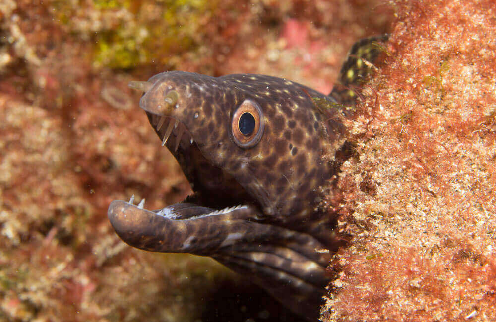
Marine Life: crabs, longlegs and red lobsters hiding in the cracks between the rocks, morays often found here, devil rays often spotted around the island.
TORM LEDGE
Depth: Average 18m, Max 35m
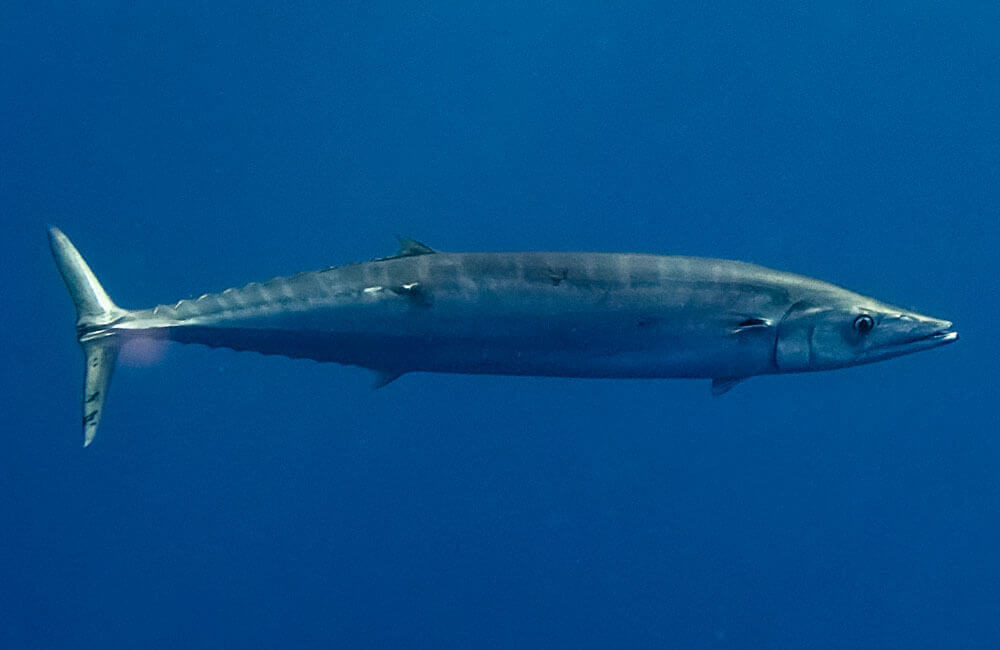
Torm Ledge is small sea mount just to the north of South West point. It has a series of mounts and ridges running from the sea bed at 35m with the shallowest part being 12m. The mount is covered with life and is a good place to spot pelagic species and larger predators (cavalley, tuna, rainbow runners).
Diving Ability Level Open Water +, Advanced Open Water preferable
Difficulty Medium
Current Can be strong due to location; only dived in suitable conditions
Marine Life Flameback angelfish, whale sharks (seasonal), larger fish
BARN LEDGE/CAP
Depth: Average 14m, Max 35m
Barn ledge or cap is a small sea mount offshore north east of the barn with a flat top at 12m but extends down to the seabed at approximately 50m. Normally dived to a maximum of 25m following the slopes and drop-offs around the cap. This is an excellent site for seeing large pelagic species.
Diving Ability Level Open Water +, Advanced Open Water preferable
Difficulty Medium – Hard
Current Frequently strong due to location; only dived in suitable conditions. Being swept off the cap is a real possibility.
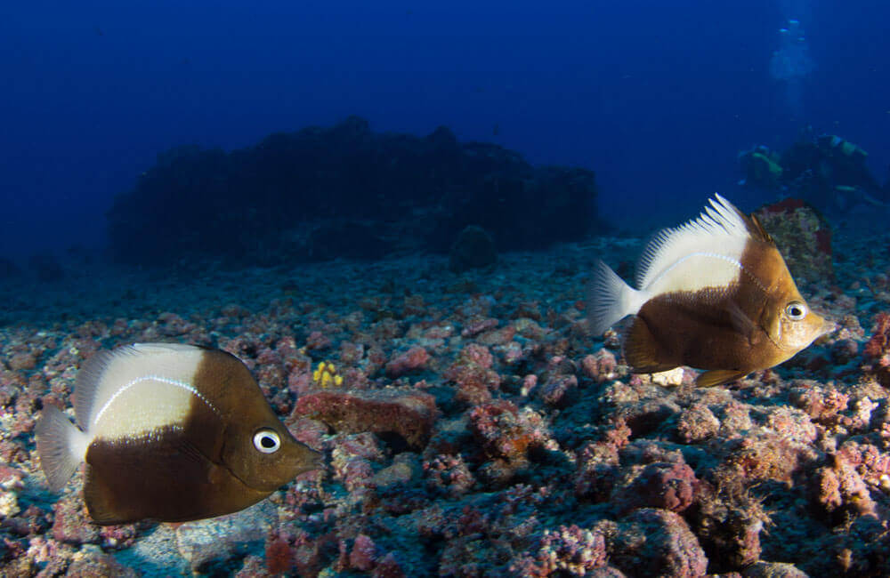
Marine Life Jack species and larger fish, large group of St Helena butterflyfish possible, whale sharks (seasonal)
BUOY’S HOLE
Depth: Average 11m, Max 20m
A sheltered location on the north of the island. The site is a large ridge which runs north to south extending 40m or so underwater. Along the end of the ridge there large hole (hence the name) with a rock archway passing above it. The site also boasts a small cave network with four entrances/exits, care must be taken in the cave due to the highly delicate fan coral that thrives there.
Diving Ability Level Open Water +
Difficulty Easy
Current Usually slight
Marine Life
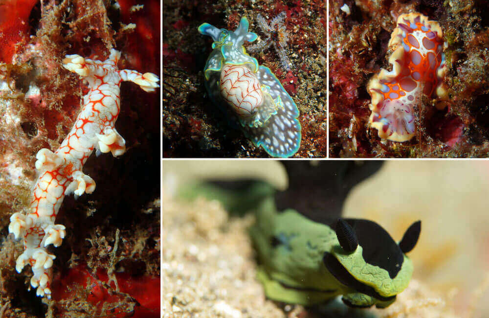
Buoy’s Hole: High level of biodiversity, bornella and tambja nudibranchs (seasonal),
Cavalley: Endemic orange cup coral and highly delicate rose lace gorgonian in caves (careful diving required)
Night dives Slipper lobster, long legs crayfish, octopus, anemones
Additional Features Cave/swim-through, great night dive
SUGAR LOAF POINT/CRACK
Depth: Average 15m, Max 28m
Description and key features: Sugar Loaf point is the most northerly point on the island. We start the dive in approximately 18m of water from where it drops down to 28m via a series of ledges, the walls of which are covered in life. At 28m there is mount which can be explored before following the ledge at 18m around to Sugar Loaf crack. The crack is a v shaped valley between the shore and an outcrop.
Diving Ability Level Open Water +, Advanced Open Water preferable
Difficulty Medium
Current Can be strong due to location; only dived in suitable conditions
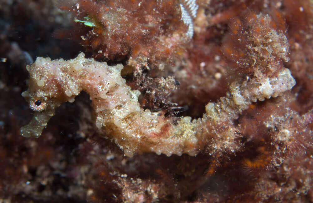
Marine Life Rare: sea horse, Long Legs Crayfish, Cavalley Jacks
Additional Features None


